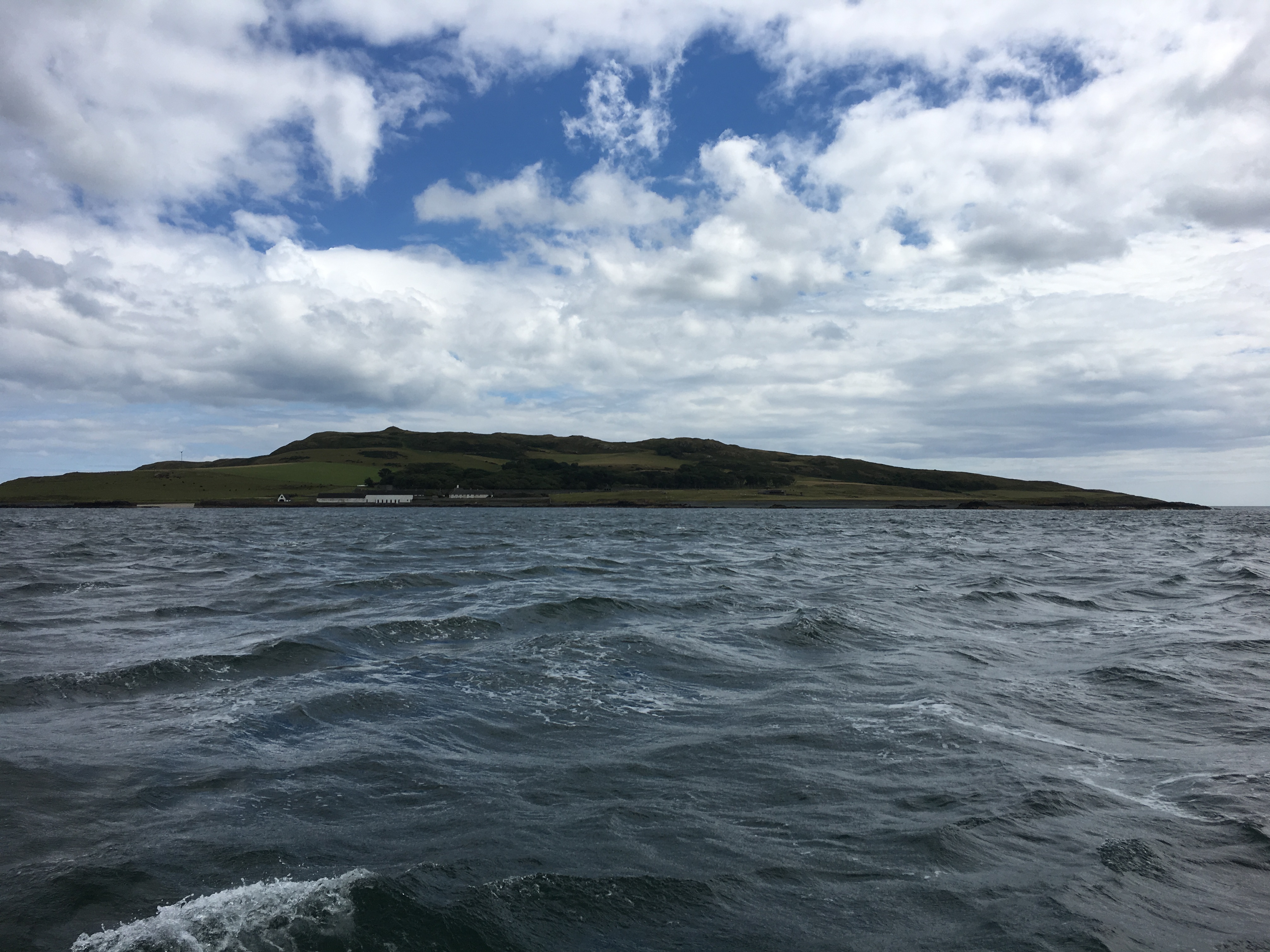
Yesterday I decided to sail to Lambay Island, north of Howth, mostly because it’s there. The tides were just right, with a low tide at 10:30 in the morning, and a high at 16:45 – perfect for catching the flood to Lambay, and the ebb back to Dun Laoghaire. Dun Laoghaire to the Bailey lighthouse was a meandering run, with a broad reach over to the western side of Lambay. The GPS indicated that I was doing somewhere past 6 knots over ground, even on the run, but I’ve got no idea what my speed through the water was, as the log has stopped reading (I suspect the local weed has got to it). Alas, the iNavX app on my iPad failed to record the whole trip, because I forgot to set the option to disable locking the device (which suspends the application). However, I did remember to turn the NavTex on, and so it logged my position every half hour; these positions have been transferred to the logbook.
A side note on iNavX – it’s decent software, and talks NMEA over WiFi. However, I think Boating HD (Navionics) has it beaten in places, particularly the ability to plot routes to take. iNavX splits the creation of waypoints from the creation of routes, which is fine when you want to build a library of waypoints, but not so fine when all you want to do is doodle a route to and from somewhere to see what the journey distance might be. In Boating HD, you can sketch out a route really quickly and get a feel for how far it is, plus there’s the compass button for measuring distance from point A to point B (which it turns out is in iNavX if you double-tap the chart). In iNavX, all I can find is manually adding a series of waypoints, and then either tapping each one to add it to a route, or going to the routes function, creating a new one, and add the waypoints by searching.
On the whole, iNavX is more practical with the NMEA integration, GRB overlays, ability to export recorded tracks, and ability to use multiple different charts. However, Boating HD certainly has some more polished functionality for armchair navigation.
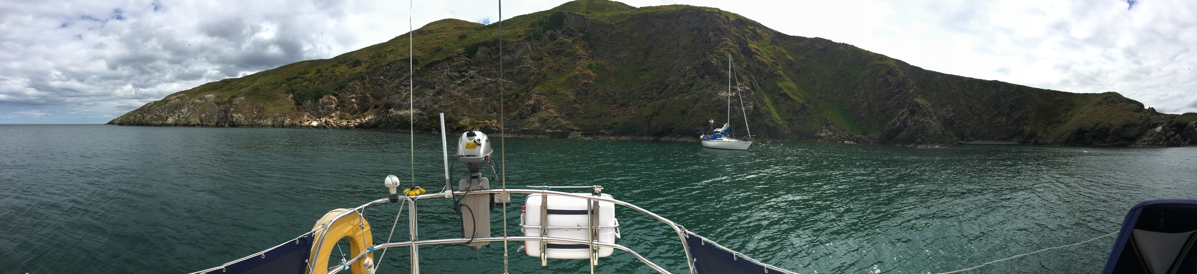
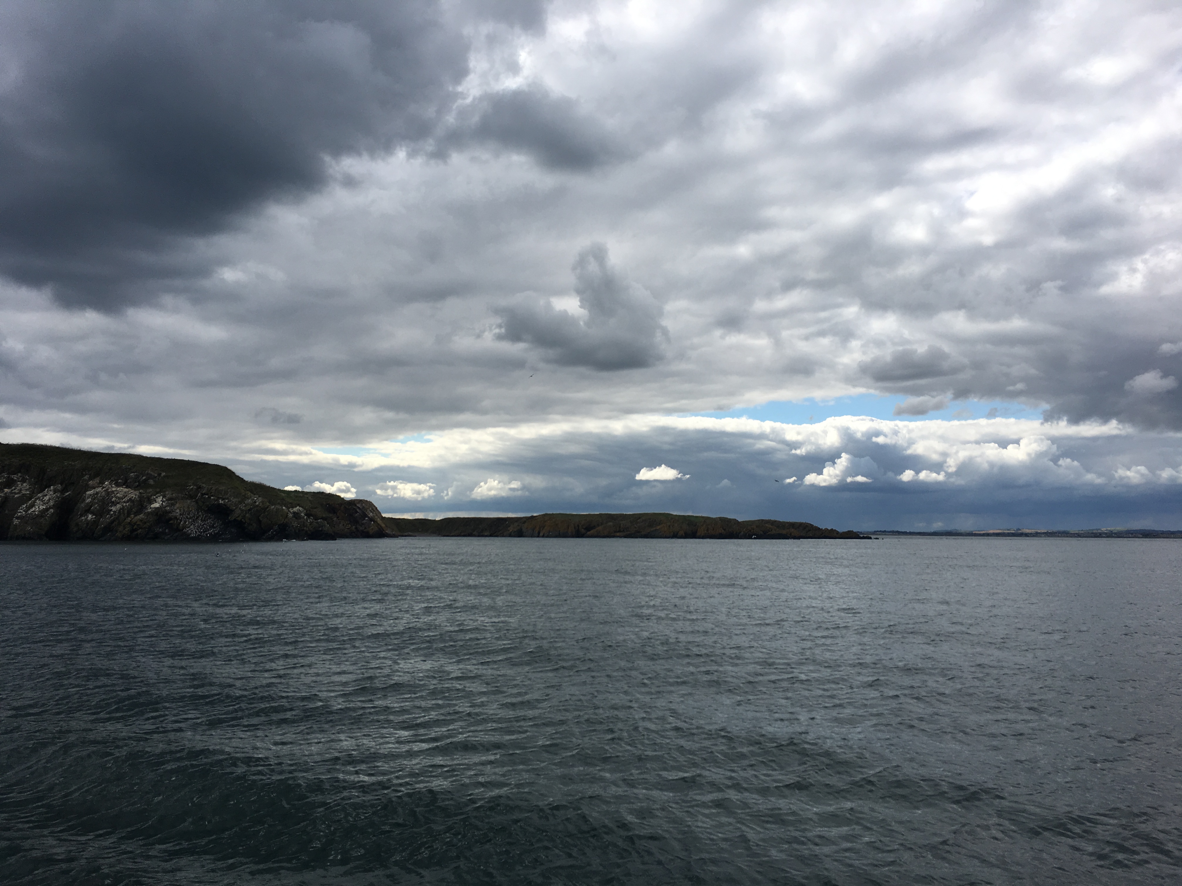
Anyway, back to the trip. Came around the western aspect of Lambay, and noted that what is drawn on the charts as a pair of western cardinal marks is in reality a tall green post with what looks like a lamp on the top, very reminiscent of a lampost that’s been stuck on a rock in the sea. There was a bit of tide rip here, and while places like Visit My Harbour indicate that the western bay can be anchored in, I suspect at anything other than slack water it’ll be a bit bumpy. The northern bay, on the other hand, was lovely and flat, though the wind was accelerating around the headland a bit (and coming out of the north west, despite the prevailing wind of the day being south west).
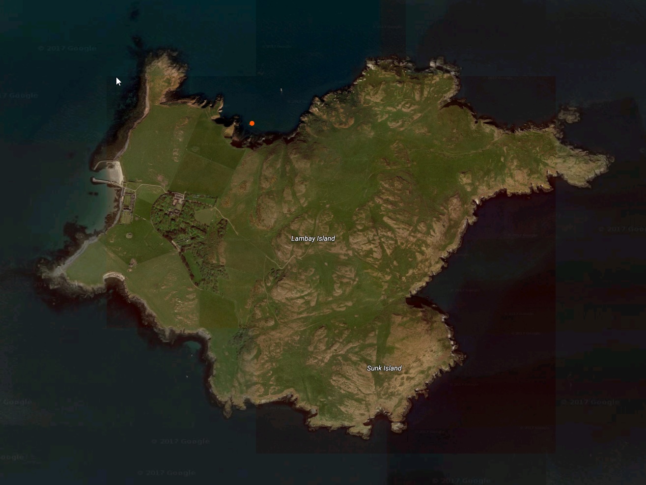
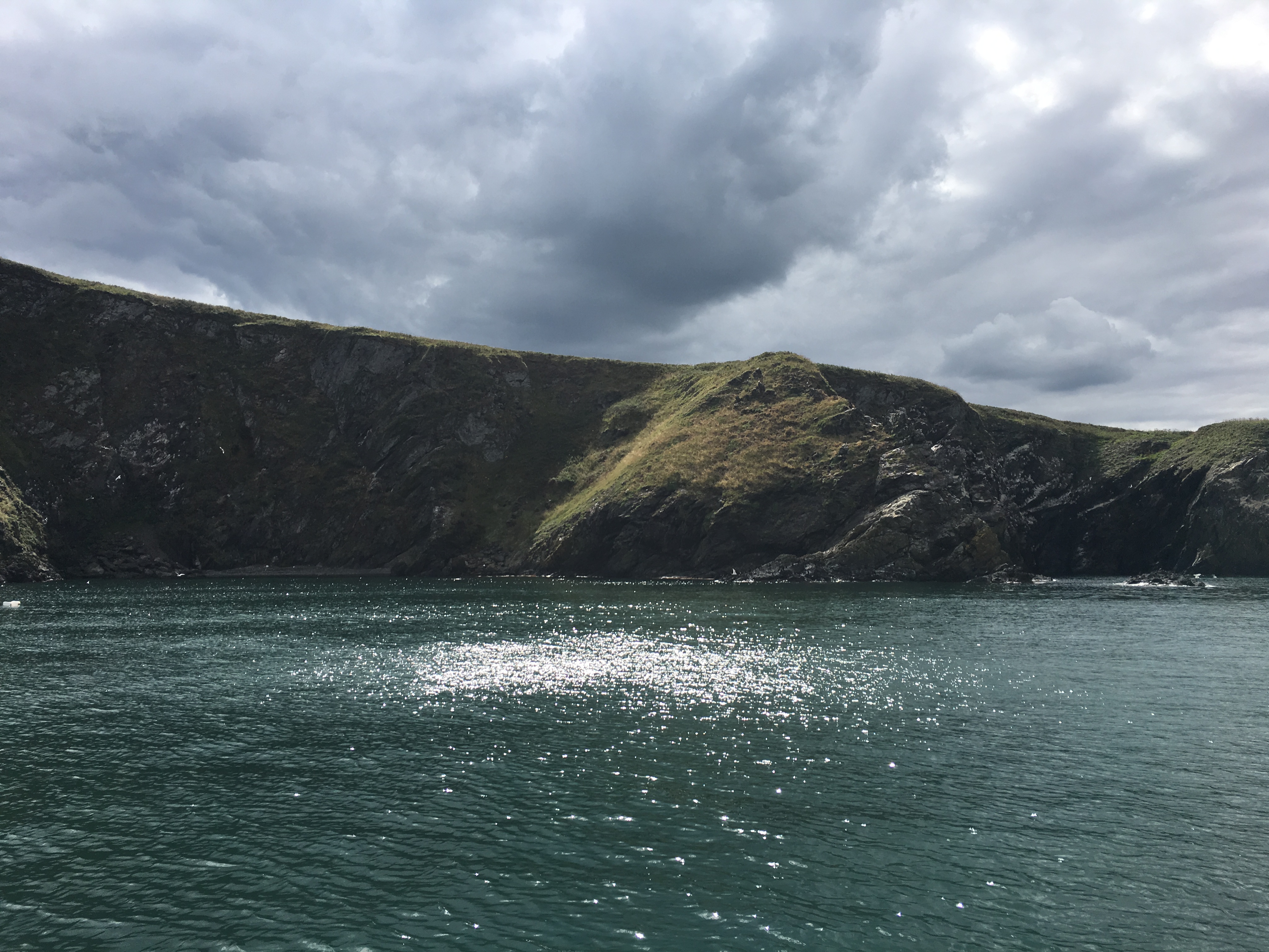
The notes about Saltpan Bay indicate that you can get right in close; I chose to keep 4 metres of water under the bottom of my keel, because I don’t know the bay well. Also, when I came in on my first approach, the yankee furler jammed solid as I tried to douse the sail, so I had to go back out of the bay under engine while I dropped the sail to the deck; by the time I was done, I just wanted to get the hook over the side so that I could have some lunch! Fixed the furler by taking the casing off and freeing the rope that had jammed under the guide of the 200S. Lunch was not the quietest lunch I’ve had, but I can’t complain too much since I had anchored next to the home of these birds.
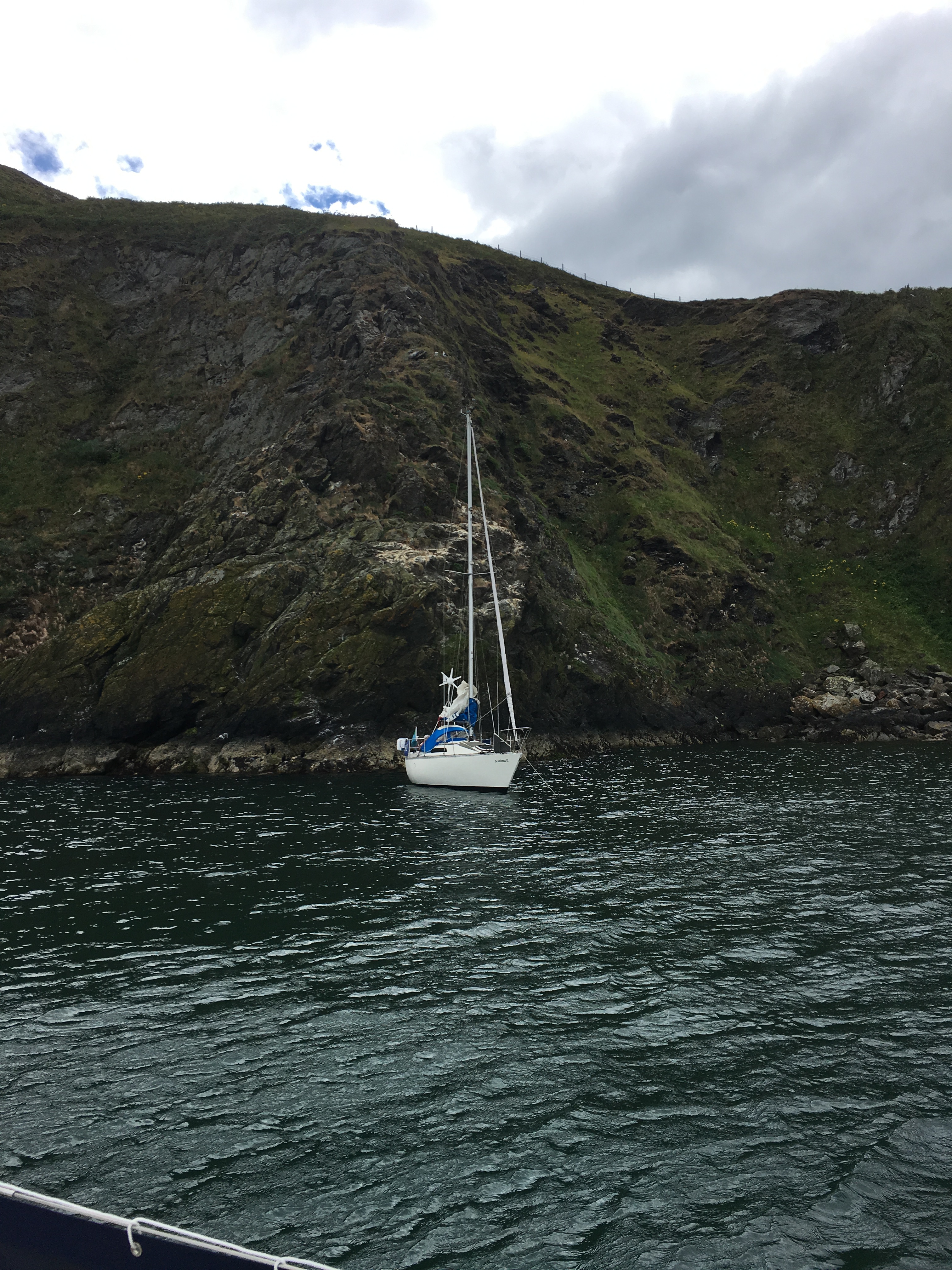
A local Howth boat showed up a little while later (seen in the 180 degree pano above), and went very close to the cliffs. However, they also managed to jam their anchor into something, and it took them a good 10 minutes to get it back on board. Well, I’m assuming they got it on board, because they eventually motored off; they could have cut the rope and left it at the bottom.
The return trip was initially under sail, and I chose to go east and around the side of the island that I hadn’t seen yet. This turned out to be an unwise choice once I made it out of the lee of Lambay. The wind had shifted a bit, and was on the nose; I tried running out to the east for a bit, and then tacked for home, but the wind steadily swung, and I found myself pointing towards Howth and Ireland’s Eye, not Dun Laoghaire. I opted to turn on the steel donkey and head for home; it was a 2 hour bumpy ride with wind against tide, and the furler jammed again. Back on the mooring by a bit after 1930, took the casing off of the furler again, freed the rope, and left the casing off. I’ll go back down this week and see about taking some extra line off of the drum and see if that makes life better.